 Shipmate Flagchart : http://www.shipmate.nl/flags.htm
adopted 1 Jan 2001

Last modified: 2003-06-14 by jarig bakker
Keywords: de bilt | knmi |
Links: FOTW homepage |
search |
disclaimer and copyright |
write us |
mirrors
 Shipmate Flagchart : http://www.shipmate.nl/flags.htm
adopted 1 Jan 2001
When sunshine has been predicted and you're hit by hailstones as big as dove-eggs you blame the weatherman on TV of course. In the Netherlands we know better: we blame the KNMI (Koninklijk Nederlands Metereologisch Instituut - Royal Dutch Metereological Institute) in De Bilt.
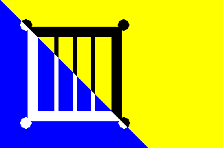
De Bilt is a suburb of Utrecht, and a new municipality, formed on 1 Jan 2001 by the merger of Maartensdijk en De Bilt, with its seat in Bilthoven. On 4 Dec 2000 HM Queen Beatrix granted a new CoA to the to-be-founded municipality, together with a flag. (Usually it takes several years...).
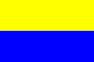
The CoA and flag are nearly identical. The yellow - blue diagonal division
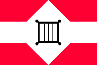
is from the old Maartensdijk flag, while the St. Lawrence grill occurred
on the old De Bilt flag and CoA. The old Oostbroek monastery was devoted
to that saint. It was founded c. 1100 A.D., and demolished c. 1580.
Source: the De Bilt municipal website.
Jarig Bakker, 2 Jun 2003
![[De Bilt CoA]](../images/n/nl-ut)db.jpg) image from the De Bilt municipal website.
image from the De Bilt municipal website.
Granted 4 Dec 2000.
 Shipmate Flagchart : http://www.shipmate.nl/flags.htm
 Shipmate Flagchart : http://www.shipmate.nl/flags.htm
 Shipmate Flagchart : http://www.shipmate.nl/flags.htm